Advertising from Space
Sunday, April 20, 2008
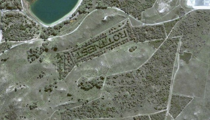
I stumbled across this image today while searching around Google Maps.
One of my frequent beefs with Google Maps is that you can find a
beautiful place but have absolutely no idea what it is called.
Turns out the folks on Rottnest Island (just off the coast of Perth, Australia) had the same beef too - so they carved out the name of the island in trees.
Now
the only question is “why is it upside down”? Did they screw it
up or is Google Maps upside-down if you look at it from an Australian
IP address? I know for a fact that Aussies have in the past been
angered that the Northern Hemisphere is traditionally (and arbitrarily)
at the top of almost all maps:
Add a Comment 

Add a Comment