Today I went out to Flushing with my buddy Rich to get some great dumplings/Szechuan food (that's another post). On the way back, I made him stop at the Queens Museum of Art to see the Panorama of New York. For those who have no idea, the Panorama is a life-size, 100% accurate replica of every single building in the five boroughs as of 1992 (It was originally built for the 1964 World's Fair).
It was really cool to see, but I couldn't help but think of how archaic it is and how every single thing it does is now available on my phone or computer.
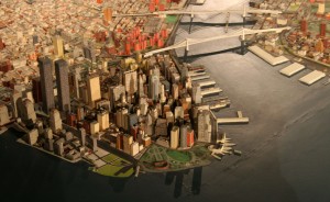
Here's a shot of the lower Manhattan portion:

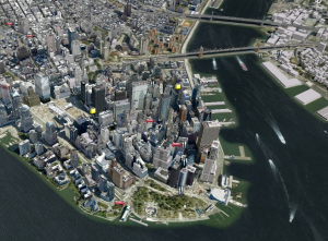
Here's how the same scene renders in Google Earth:

It's almost identical-except that the Google edition is constantly up to date, lets me zoom and has info added to highlight places of potential interest.
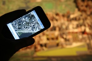
Similarly, here's a photo of both the panorama and the same location in Google Maps on my iPhone:

I've now got the Panorama to go.
In fact, I can now do things on my phone that the Panorama will never be able to do: UpNext allows me to see individual building across Manhattan in 3D. The Old Map App actually lets me watch the same point evolve through time (whereas the Panorama has only been updated twice: 1964 and 1992).
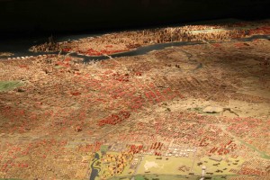
Interestingly, the Museum is now trying to make the Panorama a little more interactive: they've placed pink triangles on all locations (outside Manhattan) where 3 or more foreclosures have happened. Note the swath from Bed-Stuy to Jamaica via East New York:

Of course, this is also a totally outmoded way to do this. The New York Times' foreclosure map makes in a lot easier to visualize.
The Panorama is well worth seeing if you ever come to NYC - and seeing the model is a million times more impressive that looking at an image on a screen. It's just incredible to think that you can now take it with you everywhere you go.