I’m going to try and do something a little different here and do some trip reports from various short adventures.
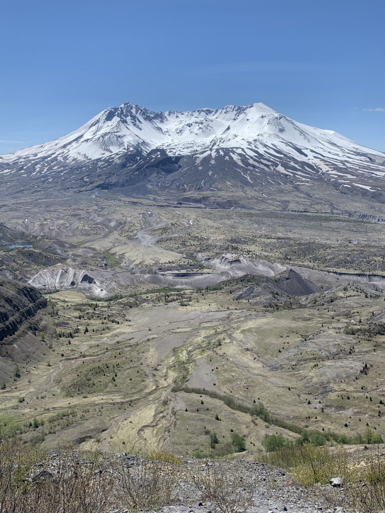
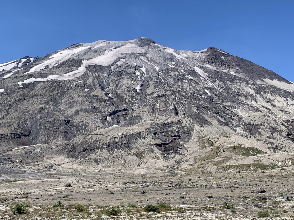
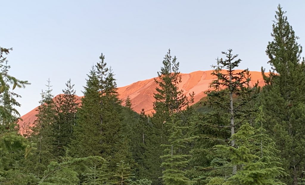
Ever since I moved to Seattle I’ve been obsessed with Mt. St. Helens. Every kid has heard about how it blew up and flattened everything to the north (not actually all around it - more on that later). The last few years we’ve made an annual pilgrimage the week before Memorial Day to hike Harry’s Ridge. From the top you get a glorious view of the blast zone:
I’d always wanted to get in there but it’s not the easiest. First, it’s a restricted area so there are only a few trails (and you have to stay on them). Second, there is no trailhead that starts there; you’ve got to hike several miles in any direction.
This weekend I finally had the chance. I had the rare free weekend and a friend suggested we try and circumnavigate all of St. Helens via the Loowit Trail. It’s 32 miles long, making this one of the few volcanos you can hike around in a weekend - for context, the Wonderland Trail around Rainier is 93 miles long.
What I learned on this hike is that Mt. St. Helens is not one mountain but many; this would turn out to be an incredible - and incredibly hard hike.
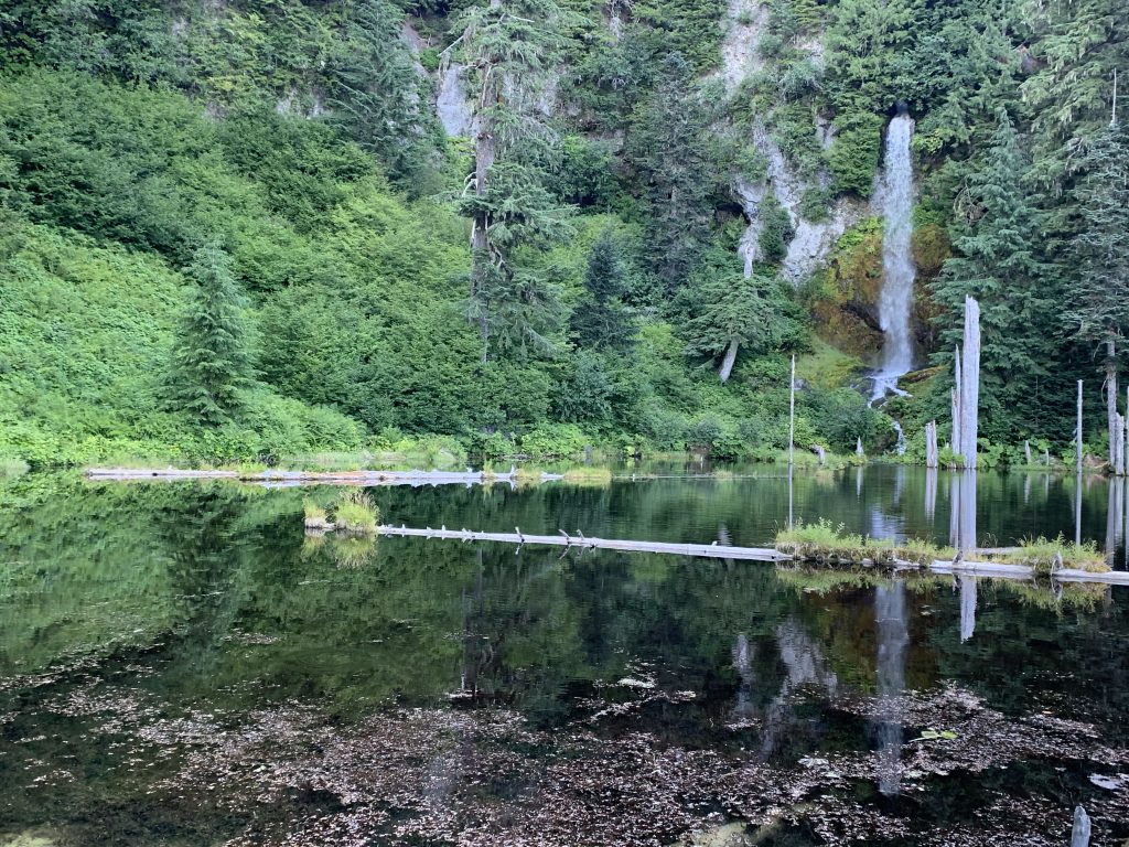
We started out to the south of the mountain at the June Lake Trailhead where it’s a short hike to June Lake and its pretty waterfall:
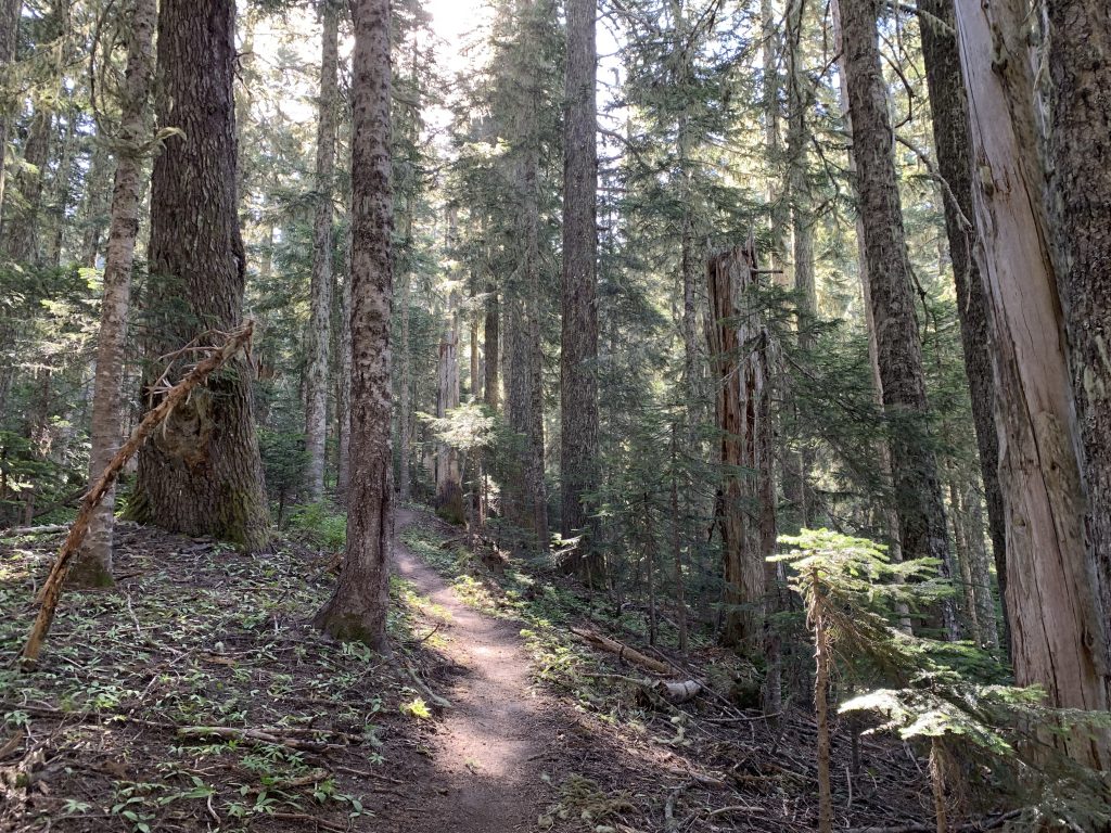
From there you start climbing - through old growth in fact. This was the first surprise I had about St. Helens. I had thought that the blast had destroyed everything on the mountain but in fact the main force went north. Some lava spilled over several sides but scattered amongst the remnants are some copses of old growth. Amazing to think that they stood there as the land around them burned.
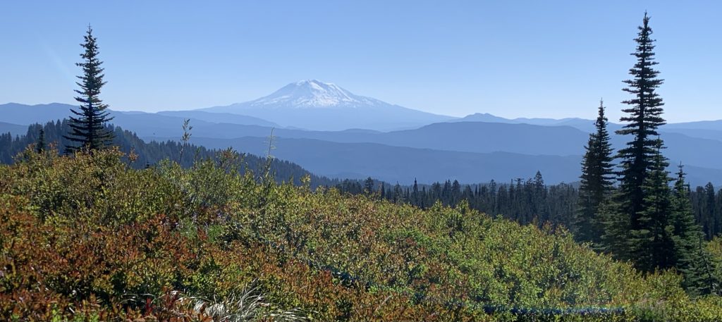
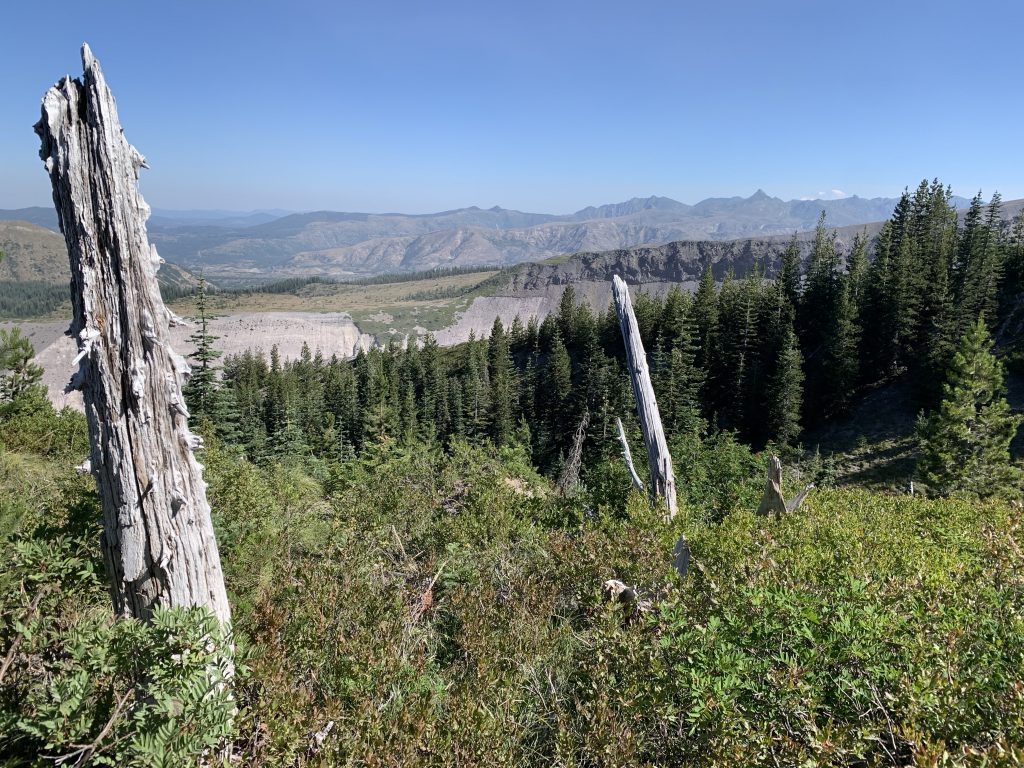
You emerge out of the forest into a rocky plain of lava - and your first glimpse of Mt. Adams. From here, it was a counter-clockwise journey around the mountain.
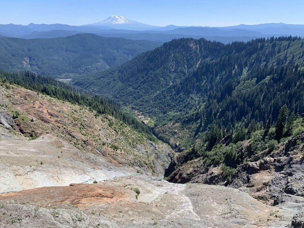
You keep climbing and circumnavigating the mountain. It’s amazing how dry the actual mountain is. The PWN is lush and has many streams but up here at 4,000+ feet the only water comes from melting snow - and there’s not much at this time of year. Ironically, there is a massive run-off earlier in the season. As you cross massive eroded canyons you come across dry waterfalls
After five miles or so you end up at the “Plains of Abraham”. There’s a spring here - your last guaranteed source of water until you cross the blast zone and reach the Toutle River. It’s also a nice place to stop for lunch; cool air rushes up from the valley below.
The view above is deceiving though because the Plains of Abraham is a beautifully bleak place.
The peak looms over a vast plain of pumice. There is only one hill with any green and it is covered with wind-blown trees that are precariously balanced on the top of it. A great violence happened here in 1980.
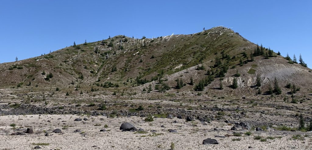
After you’ve hiked across it and up the pass at the end, you can look back and get a true sense of its proportions (it’s about 5 miles long). One of the strange things about Washington State is that while the coast is lush, you can frequently find yourself in a desert that feels like the surface of the moon. The Plains of Abraham definitely fit that bill.
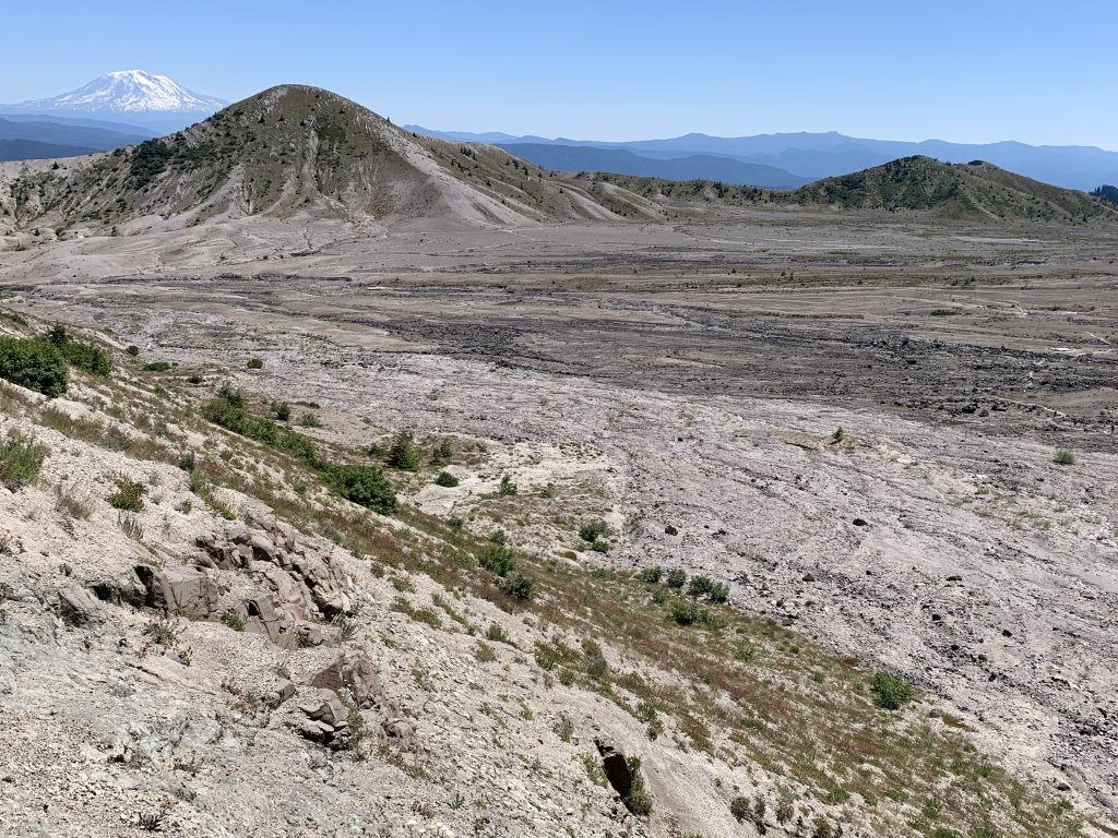
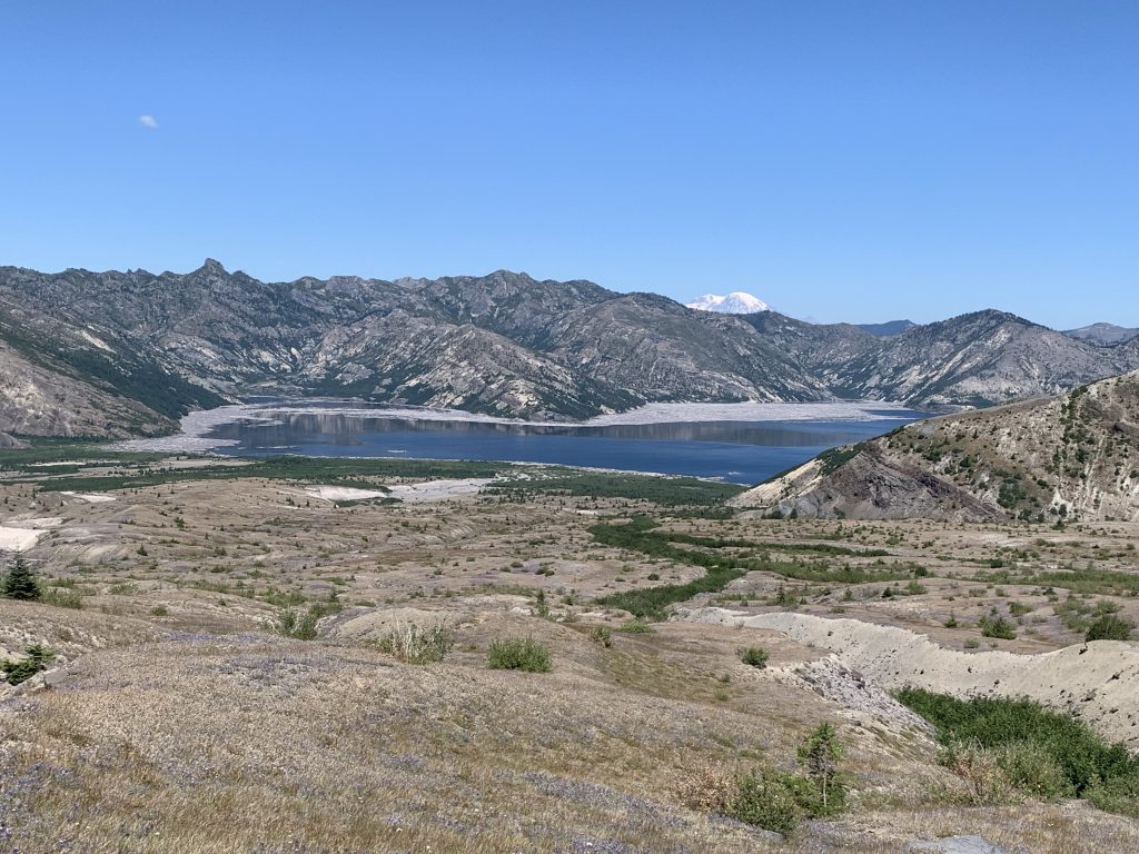
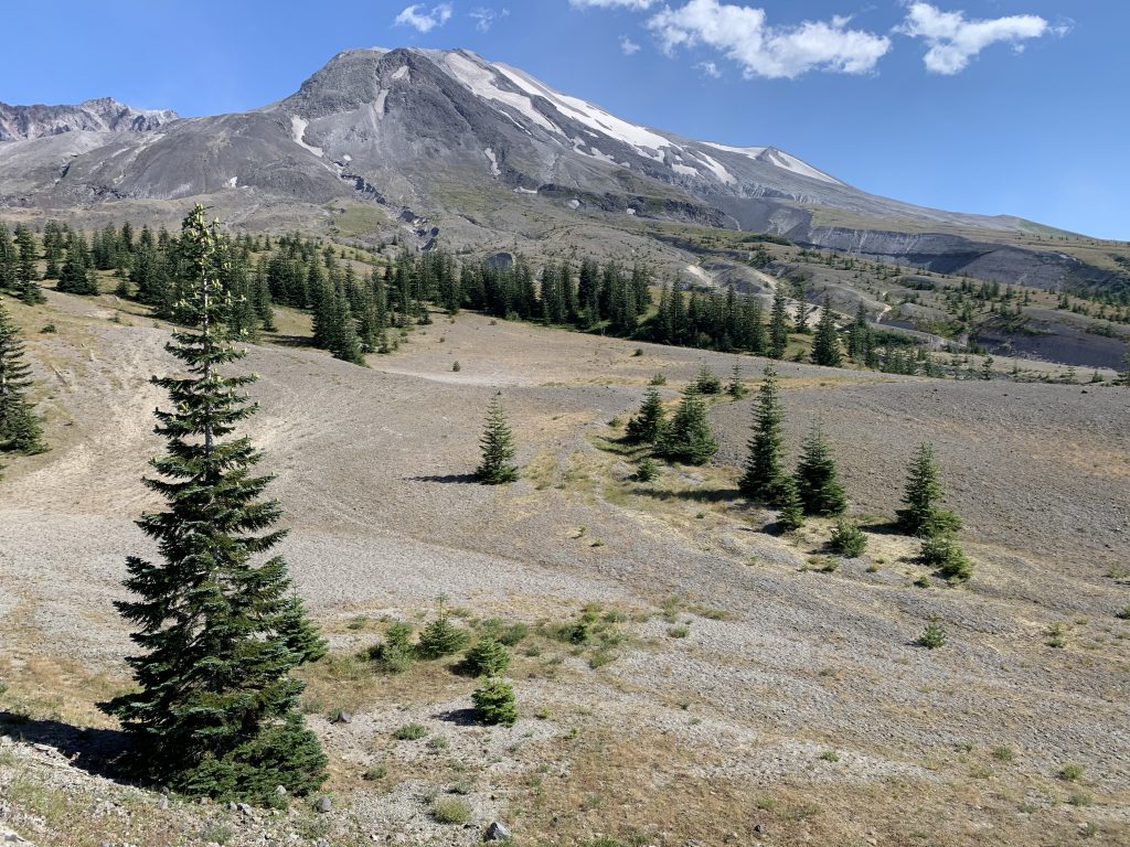
From there, you descend into the blast zone and get your first view of the timber-covered Spirit Lake. It used to be entirely covered; there are still thousands of trees on top of it.
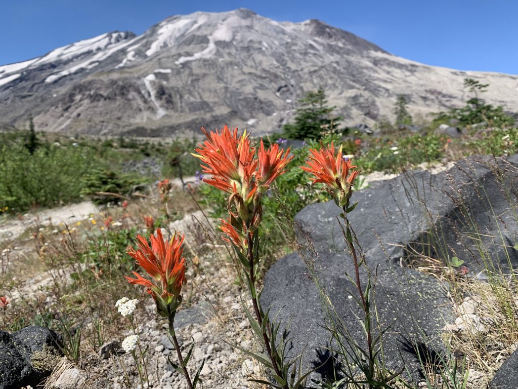
By this point we’d been walking in the sun for about six miles or so. The blast zone offers no respite. One reason the views are so beautiful is that there is almost zero shade. In some stream channels you may come across some high bushes but otherwise you are under the pounding sun. The corollary is that you have incredible unimpeded views.
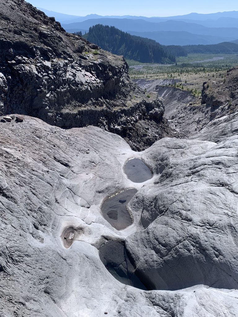
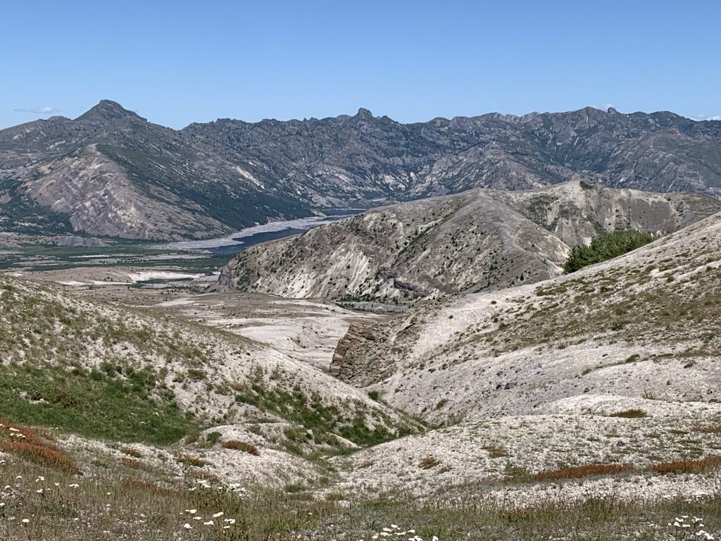
Staring up into the crater is surreal. There are several hundred foot cliffs of volcanic ash that are slowly being carved away and carried downriver.
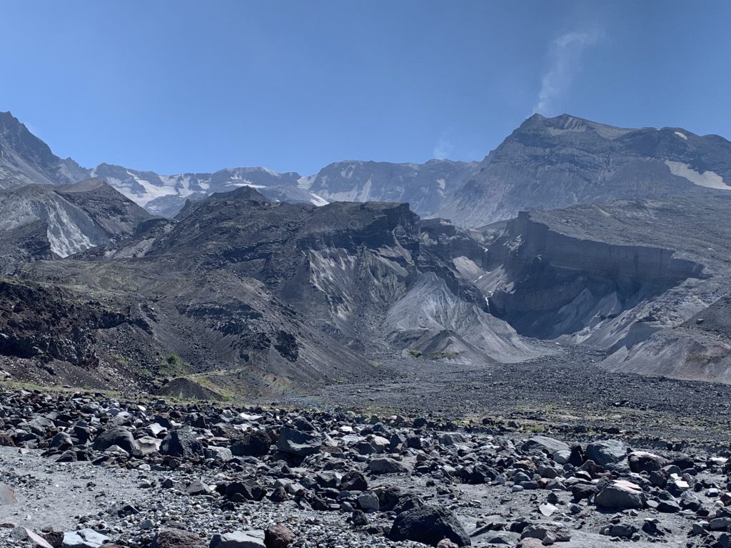
And then you’re out of the main blast zone. Trees start re-appearing and it feels like you’re in a different universe.
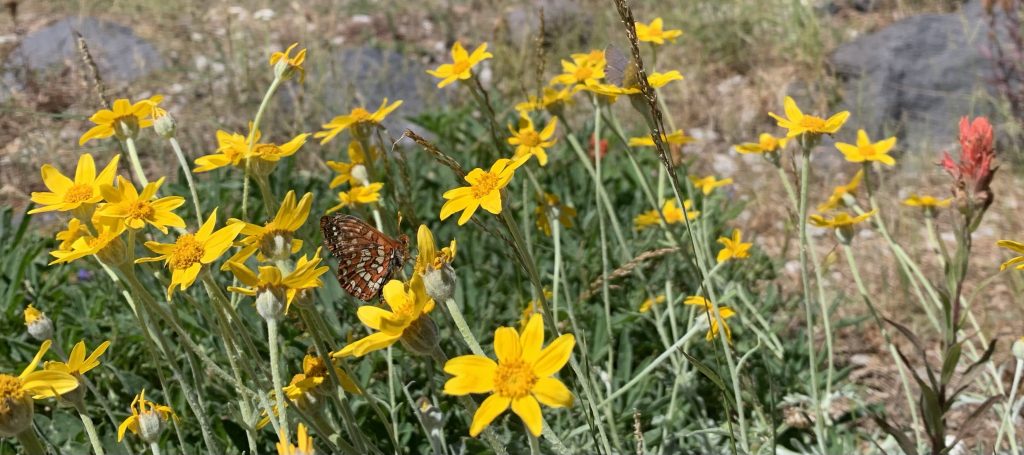
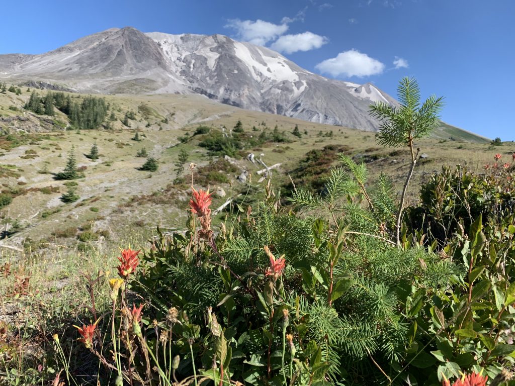
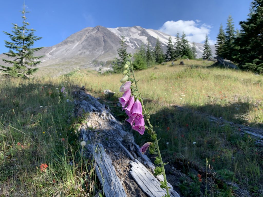
This is getting towards the end of Day 1. You climb up to a ridge above the Toutle River and you’re surrounded by wildflowers.
This is a prelude to a harrowing descent to the campsite (you have to clear the river; there is no camping in the blast zone). You have to lose about 800 feet of elevation while going down a 45 degree slope of sand and scree. Keep your eyes on the trail and don’t look down!
But the alpenglow from the campsite is amazing:
Day 2 starts with a massive climb of over a thousand feet. The canyons are large on the west side of the mountain; get ready for some up and down. Fortunately, you’re temporarily in the shade of an old growth forest, amongst hundred foot ancient trees:
At the top of the climb you can just see the ridge you came down yesterday. The whole thing is maybe a few thousand feet away - but to get there you’re going to have to go down over a thousand feet, cross a river (with ropes to climb in and out of the river) and then rapidly ascent 800 feet. The scale of St. Helens is stunning.
At this point you’ve entered an arid region that feels more like California. There is no water and the pine trees are unlike any found elsewhere on the mountain. Fortunately, you’re hiking along a contour line and just slowly losing elevation.
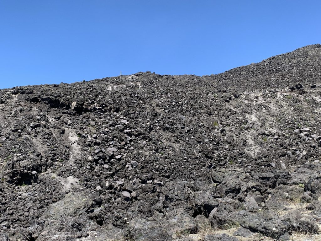
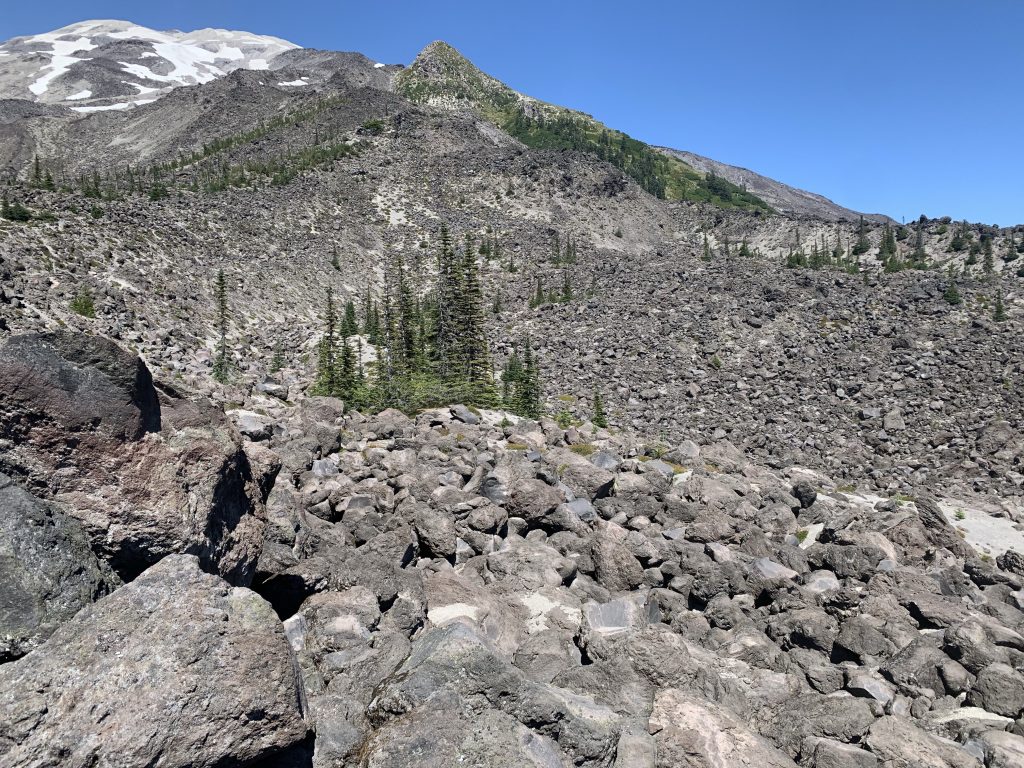
But the mountain still has surprises in store for you. The next third of the mountain over-indexes for crossing lave fields. You need to find a trail over millions of small boulders spit out of the mountain - and the sun is shining and there’s no shade.
Cross a few of these while trying not to twist your ankle and then you’ll find yourself back at June Lake
So was it fun or was it a slog?
Both.
I’ve never crammed so much hiking into a weekend and the heat plus exposure was absolutely punishing. I’ve also never seen so many different biospheres so quickly: old growth forest, lava fields, meadows, alpine terrain and more. The mountain is recovering and it’s amazing to see nature find a way in every nook and cranny.